


DJI Zenmuse P1
0.00 ₾
The New Benchmark for Aerial Surveying
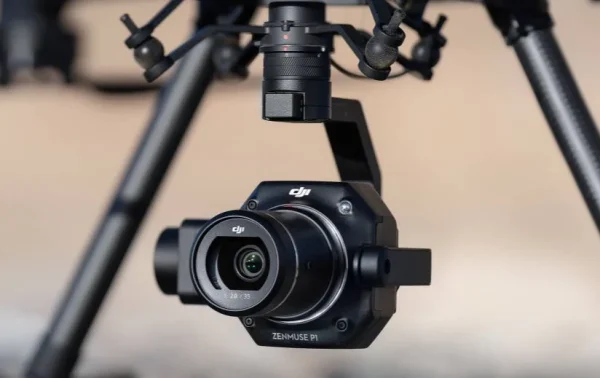
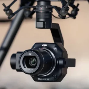
The Zenmuse P1 integrates a full-frame sensor with interchangeable fixed-focus lenses on a 3-axis stabilized gimbal. Designed for photogrammetry flight missions, it takes efficiency and accuracy to a whole new level.
Additional information
| Brands | |
|---|---|
| Condition | |
| Seller | |
| Industries | Construction, 3D scanning, Cadastre, Communication, Geodesy, GIS & Mapping, Maining, Monitoring, Oil & Gas, Remote Sensing |
Delivery Service
Megageohub delivers products purchased up to 500 (five hundred) GEL within the city of Tbilisi by the postal service selected by it for 10 GEL, within 2 working days of purchase, and in the region for 20 GEL, within 5 working days of purchase. Delivery of items above 500 (five hundred) GEL is free.
Item Ordering Conditions
You can order this item from us, send us your contact details and we will contact you within 48 hours.
Product delivery time is 15-30 days.
To order the product, send us your contact details
- Description
- Additional information
Description
| General | |
| Product Name | ZENMUSE P1 |
| Dimensions | 198×166×129 მმ. |
| Weight | 800 გრ. |
| Power | 20 ვატი |
| IP Rating | IP4X |
| Operating Temperature Range | -20° to 50° C |
| System Performance | |
| Detection Range | – |
| Point Rate | – |
| System Accuracy | – |
| Real-time Point Cloud Coloring Modes | – |
| Lidar | |
| Ranging Accuracy | – |
| Maximum Returns Supported | – |
| Scan Modes | – |
| FOV | – |
| Inertial Navigation System | |
| IMU Update Frequency | – |
| Yaw Accuracy | – |
| Pitch / Roll Accurac | – |
| Auxiliary Positioning Vision Sensor | |
| Resolution | – |
| FOV | – |
| RGB Mapping Camera | |
| sensor | 35.9×24 mm – 45MP |
| lens | 24/35/50 მმ. |
| ISO range | 100-25600 |
| shutter speed | 1/2000 – 1/8000 |
| Maximum photo resolution | 3:2 (8192×5460) |
| Photo shooting modes | – |
| video resolution | 16:9 (3840×2160) (35 მმ) |
| Maximum video bitrate | 60fps |
| Photo format | – |
| video format | MP4,MOV |
| Gimbal | |
| stabilization system | 3 ღერძა |
| mechanical range | 130-40, 55-55, 320 |
| controlled range | – |
| Maximum control speed (tilt) | – |
| Data Storage | |
| Raw Data Storage | – |
| Supported microSD Cards | SD: მაქს: 512 გბ |
| Post-processing Software | |
| Supported Software | – |
| Data Format | Photo / GNSS Raw Observation Data/ Image Log File |
Additional information
| Brands | |
|---|---|
| Condition | |
| Seller | |
| Industries | Construction, 3D scanning, Cadastre, Communication, Geodesy, GIS & Mapping, Maining, Monitoring, Oil & Gas, Remote Sensing |


