


Stonex XFLY 120
106,465.00 ₾
Accurate & Reliable
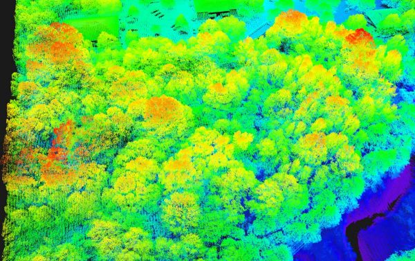
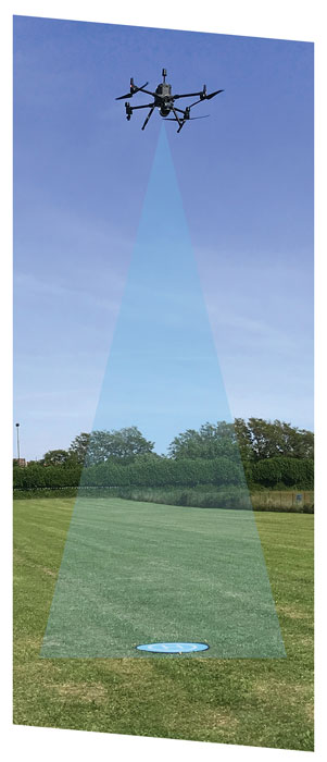
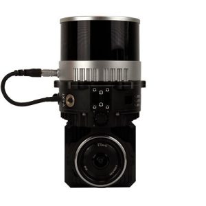
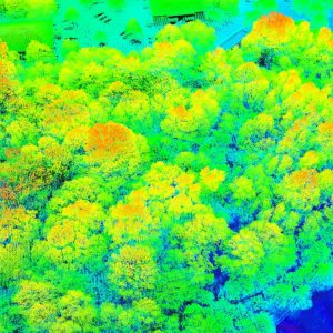
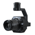
XFLY series integrates high performance Inertial Navigation System with camera and LiDAR for point cloud generation. Different customer’s need can be met by the choice of Hesai LiDAR XFLY120, XFLY300 or other sensors.
The processing platform contains a Wi-Fi interface, an embedded cellular modem for RTCM corrections, data logging software and a gigabit Ethernet network.
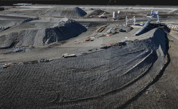
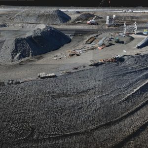
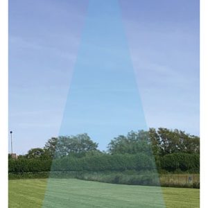
Equipped with a high-performance INS, it delivers clean point clouds even at high AGL. As a small, lightweight and low-power system, it allows the user to fly longer, adapting to the needs of any project. The post-processing software provides fully automatic point cloud generation.
Additional information
| Brands | |
|---|---|
| Condition | |
| Seller | |
| Industries | Construction, 3D scanning, Cadastre, Communication, Geodesy, GIS & Mapping, Maining, Monitoring, Oil & Gas, Remote Sensing |
Delivery Service
Megageohub delivers products purchased up to 500 (five hundred) GEL within the city of Tbilisi by the postal service selected by it for 10 GEL, within 2 working days of purchase, and in the region for 20 GEL, within 5 working days of purchase. Delivery of items above 500 (five hundred) GEL is free.
Item Ordering Conditions
You can order this item from us, send us your contact details and we will contact you within 48 hours.
Product delivery time is 15-30 days.
To order the product, send us your contact details
- Description
- Additional information
Description
| General | |
| Product Name | Stonex XFLY 120 |
| Dimensions | 20.8×14.2×17 სმ. |
| Weight | 1.7 კგ. |
| Power | 33 წთ. |
| IP Rating | 3 სმ. |
| Operating Temperature Range | 256 გბ |
| System Performance | |
| Detection Range | 0,5-120 მ. |
| Point Rate | |
| System Accuracy | 3 სმ. |
| Real-time Point Cloud Coloring Modes | – |
| Lidar | |
| Ranging Accuracy | 1 სმ. |
| Maximum Returns Supported | 2 |
| Scan Modes | – |
| FOV | 360/31 |
| Inertial Navigation System | |
| IMU Update Frequency | – |
| Yaw Accuracy | – |
| Pitch / Roll Accurac | – |
| Auxiliary Positioning Vision Sensor | |
| Resolution | – |
| FOV | 70 |
| RGB Mapping Camera | |
| sensor | Sony E-mount |
| lens | 16 მმ. |
| ISO range | – |
| shutter speed | – |
| Maximum photo resolution | 24 მგპ |
| Photo shooting modes | – |
| video resolution | – |
| Maximum video bitrate | – |
| Photo format | – |
| video format | – |
| Gimbal | |
| stabilization system | – |
| mechanical range | – |
| controlled range | – |
| Maximum control speed (tilt) | – |
| Data Storage | |
| Raw Data Storage | კი |
| Supported microSD Cards | კი |
| Post-processing Software | |
| Supported Software | Flypost |
| Data Format | – |
Additional information
| Brands | |
|---|---|
| Condition | |
| Seller | |
| Industries | Construction, 3D scanning, Cadastre, Communication, Geodesy, GIS & Mapping, Maining, Monitoring, Oil & Gas, Remote Sensing |


